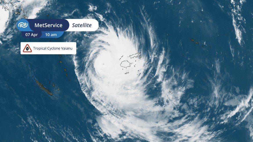
Cyclone Vaianu Upgraded to Category 3
Cyclone Vaianu was upgraded to Category 3 on Tuesday after wind speeds near the centre of the storm exceeded 150km/h. The cyclone is currently located northwest of Fiji and continues to move southeast toward New Zealand.
Meteorologists say the storm may remain at Category 2 or 3 strength as it approaches the country, which is unusual for a tropical cyclone moving this far south.
Which Areas of New Zealand Could Be Affected?
Northland and Auckland are expected to be the first regions hit by Cyclone Vaianu. Forecast models show the system tracking directly over the upper North Island before moving further south towards the East Coast.
Other regions that could experience severe weather include:
- Waikato
- Bay of Plenty
- Coromandel
- Gisborne
- Hawke’s Bay
- Manawatū
- Tararua District
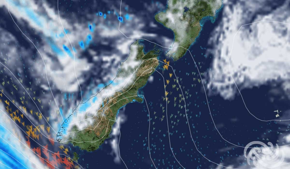
MetService says strong winds could spread from Northland through much of the North Island by Sunday, while heavy rain may trigger local flooding and slips in vulnerable areas.
Heavy Rain and Strong Winds Expected
Forecasters warn that Cyclone Vaianu could bring several days of wet and windy weather before the main storm arrives.
A separate subtropical low is already causing heavy rain across northern New Zealand this week. In Northland, rain warnings are in place, with some areas expected to receive between 90mm and 120mm of rain before Cyclone Vaianu even arrives. This means the ground may already be saturated, increasing the risk of flooding when the cyclone reaches the country.
Winds are also expected to strengthen significantly. Exposed coastal and hill areas could experience severe gale-force winds, especially across Northland, Auckland, and eastern regions of the North Island. Large swells and rough seas are also forecast, creating dangerous conditions along beaches and coastal roads.
When Will Cyclone Vaianu Reach New Zealand?
Current forecasts suggest that the first impacts from Cyclone Vaianu may begin late Friday or Saturday. However, the most severe weather is expected on Sunday, when the storm is forecast to move across the upper North Island.
MetService says there is still some uncertainty around the exact track of the cyclone. Even a small change in direction could alter which regions receive the strongest winds and heaviest rain. Residents are being urged to monitor official weather updates throughout the week.


